Terrain study
Create a visual study of shaded relief using a Sample Elevation Model and document with a 500 - 750 word explanation/reflection of design choices.
You should model the visual study on Plates 5-6 or Plates 11-12 and 14 from Eduard Imhof’s Cartographic Relief Presentation.
Please note: there is no need to create a separate map taxonomy sheet as you have for the two previous projects (because the study itself functions as a taxonomy).
For your written explanation/reflection, please try to respond to these four prompts:
- What does your study try to compare?
- Why did you decide to focus on these elements?
- How do you interpret the comparisons you show (what differences and similarities do you see)?
- What principles or rules of thumb for making shaded relief base maps does your study suggest?
Terrain map examples
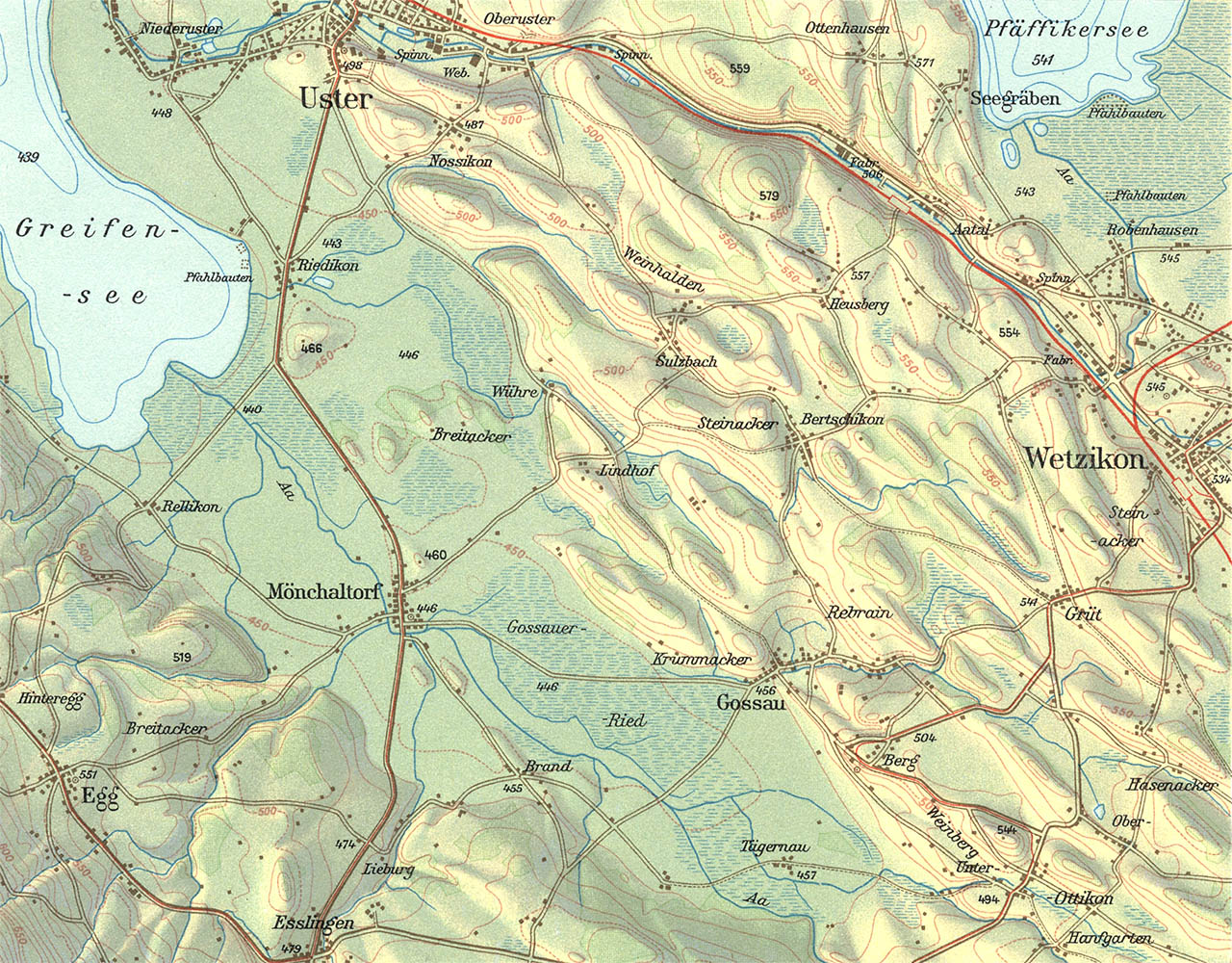
Glaziallandschaft im Glattal, by Eduard Imhof
Please note: the image above may appear broken in some browsers. Here is a link to the image index.
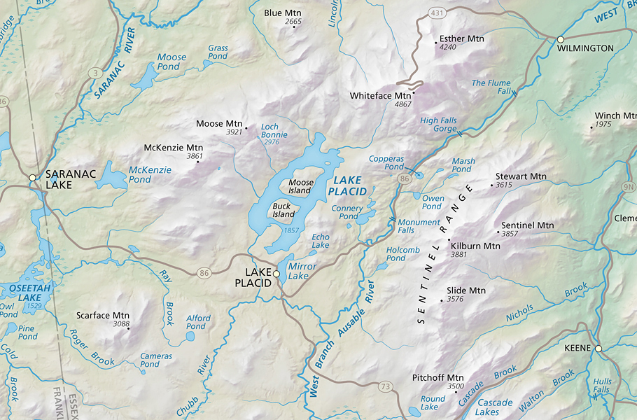
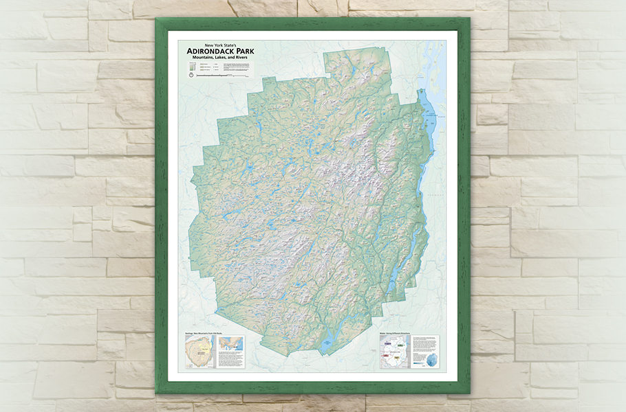
Adirondack Park Wall Maps
by Tom Patterson
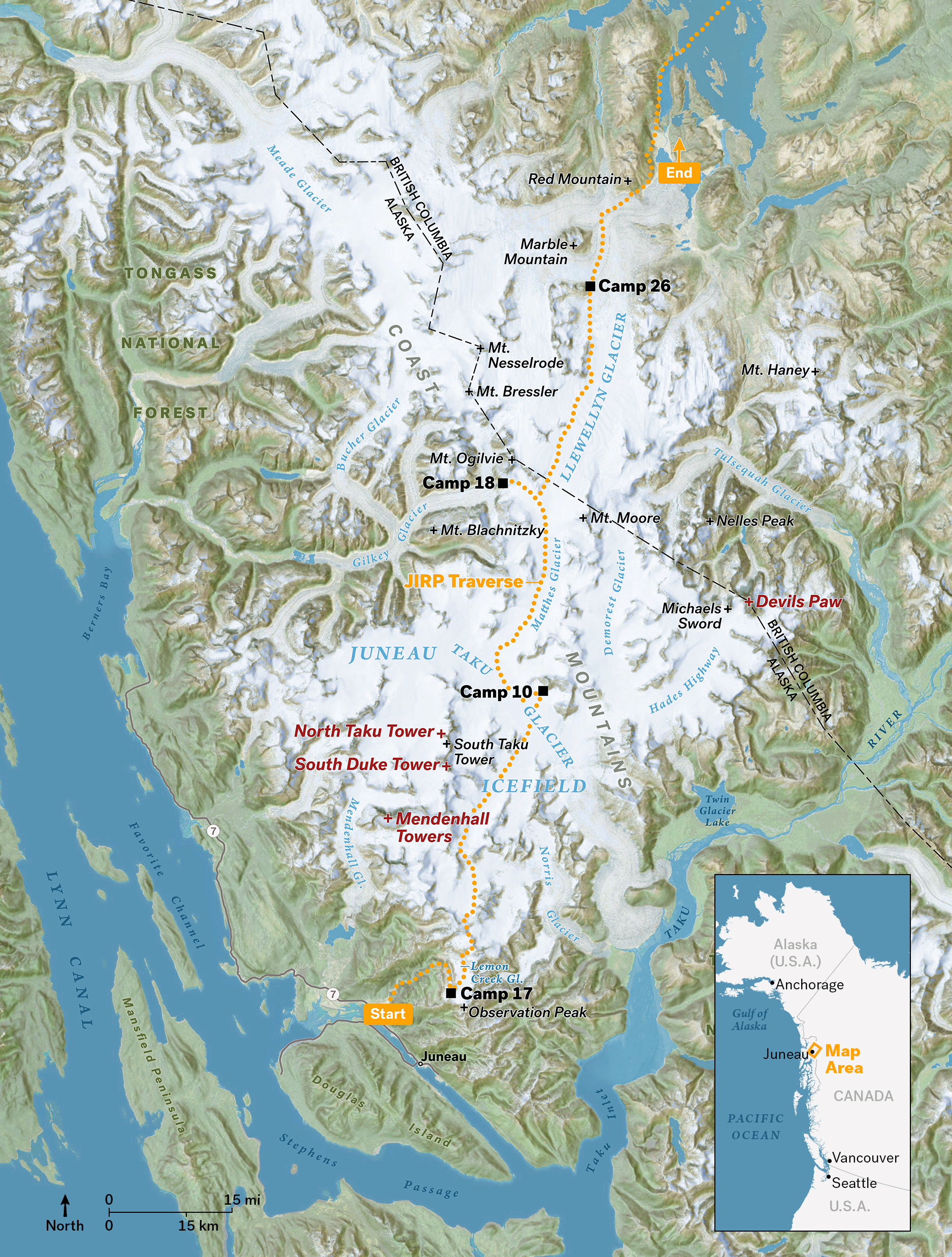
Juneau Trek
by Marty Schnure